


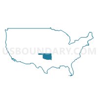
Stephens, Caddo, Comanche (North), Tillman, Jefferson & Cotton Counties PUMA, Oklahoma
About
Outline
%2c+Tillman%2c+Jefferson+%26+Cotton+Counties+PUMA%2c+Oklahoma_A280.png)
Summary
| Unique Area Identifier | 193786 |
| Name | Stephens, Caddo, Comanche (North), Tillman, Jefferson & Cotton Counties PUMA |
| State | Oklahoma |
| Area (square miles) | 5,023.03 |
| Land Area (square miles) | 4,944.43 |
| Water Area (square miles) | 78.60 |
| % of Land Area | 98.44 |
| % of Water Area | 1.56 |
| Latitude of the Internal Point | 34.26045980 |
| Longtitude of the Internal Point | -97.96276590 |
Maps
%2c+Tillman%2c+Jefferson+%26+Cotton+Counties+PUMA in Oklahoma.png)
Graphs
Select a template below for downloading or customizing gragh for Stephens, Caddo, Comanche (North), Tillman, Jefferson & Cotton Counties PUMA, Oklahoma
%2c+Tillman%2c+Jefferson+%26+Cotton+Counties+PUMA%2c+Oklahoma_T0.png)
%2c+Tillman%2c+Jefferson+%26+Cotton+Counties+PUMA%2c+Oklahoma_T1.png)
%2c+Tillman%2c+Jefferson+%26+Cotton+Counties+PUMA%2c+Oklahoma_T2.png)
%2c+Tillman%2c+Jefferson+%26+Cotton+Counties+PUMA%2c+Oklahoma_T3.png)
%2c+Tillman%2c+Jefferson+%26+Cotton+Counties+PUMA%2c+Oklahoma_T4.png)
%2c+Tillman%2c+Jefferson+%26+Cotton+Counties+PUMA%2c+Oklahoma_T5.png)
%2c+Tillman%2c+Jefferson+%26+Cotton+Counties+PUMA%2c+Oklahoma_T6.png)
%2c+Tillman%2c+Jefferson+%26+Cotton+Counties+PUMA%2c+Oklahoma_T7.png)
%2c+Tillman%2c+Jefferson+%26+Cotton+Counties+PUMA%2c+Oklahoma.png)
Neighbors
Neighoring Public Use Microdata Area (by Name) Neighboring Public Use Microdata Area on the Map
- Canadian County--Oklahoma City (West) PUMA, OK
- Carter, Garvin, Murray, Love & Pontotoc (West) Counties PUMA, OK
- Comanche County (Central)--Lawton City PUMA, OK
- Grady, McClain & Pottawatomie (South) Counties PUMA, OK
- North Texas Regional Planning Commission (Outside Wichita County) & Wise County PUMA, TX
- North Texas Regional Planning Commission--Wichita County--Wichita Falls City PUMA, TX
- Panhandle & Northwest Oklahoma PUMA, OK
- Southwest Oklahoma PUMA, OK
Top 10 Neighboring County (by Population) Neighboring County on the Map
- Wichita County, TX (131,500)
- Comanche County, OK (124,098)
- Canadian County, OK (115,541)
- Grady County, OK (52,431)
- Carter County, OK (47,557)
- Stephens County, OK (45,048)
- Caddo County, OK (29,600)
- Garvin County, OK (27,576)
- Custer County, OK (27,469)
- Jackson County, OK (26,446)
Top 10 Neighboring County Subdivision (by Population) Neighboring County Subdivision on the Map
- Duncan CCD, Stephens County, OK (28,807)
- Chickasha CCD, Grady County, OK (20,375)
- Southeast Comanche CCD, Comanche County, OK (16,988)
- Weatherford CCD, Custer County, OK (12,988)
- Burkburnett CCD, Wichita County, TX (11,496)
- Fort Sill CCD, Comanche County, OK (10,996)
- Southwest Comanche CCD, Comanche County, OK (10,857)
- Anadarko CCD, Caddo County, OK (10,821)
- Marlow CCD, Stephens County, OK (8,477)
- Amber-Pocasset CCD, Grady County, OK (6,981)
Top 10 Neighboring Place (by Population) Neighboring Place on the Map
- Duncan city, OK (23,431)
- Anadarko city, OK (6,762)
- Marlow city, OK (4,662)
- Frederick city, OK (3,940)
- Hinton town, OK (3,196)
- Cache city, OK (2,796)
- Walters city, OK (2,551)
- Elgin city, OK (2,156)
- Waurika city, OK (2,064)
- Carnegie town, OK (1,723)
Top 10 Neighboring Elementary School District (by Population) Neighboring Elementary School District on the Map
- Pioneer Public School, OK (1,287)
- Grandview Public School, OK (758)
- Zaneis Public School, OK (638)
- Terral Public School, OK (518)
Top 10 Neighboring Unified School District (by Population) Neighboring Unified School District on the Map
- Lawton Public Schools, OK (92,621)
- Duncan Public Schools, OK (23,674)
- Burkburnett Independent School District, TX (22,258)
- Altus Public Schools, OK (20,897)
- Weatherford Public Schools, OK (13,015)
- Vernon Independent School District, TX (12,955)
- Anadarko Public Schools, OK (9,059)
- Cache Public Schools, OK (7,884)
- Elgin Public Schools, OK (7,654)
- Marlow Public Schools, OK (7,227)
Top 10 Neighboring State Legislative District Lower Chamber (by Population) Neighboring State Legislative District Lower Chamber on the Map
- State House District 69, TX (140,554)
- State House District 68, TX (135,942)
- State House District 49, OK (38,581)
- State House District 42, OK (37,553)
- State House District 51, OK (37,430)
- State House District 22, OK (36,386)
- State House District 63, OK (36,149)
- State House District 50, OK (35,868)
- State House District 57, OK (35,577)
- State House District 65, OK (35,531)
Top 10 Neighboring State Legislative District Upper Chamber (by Population) Neighboring State Legislative District Upper Chamber on the Map
- State Senate District 30, TX (823,594)
- State Senate District 24, OK (98,936)
- State Senate District 22, OK (98,783)
- State Senate District 23, OK (80,676)
- State Senate District 31, OK (78,520)
- State Senate District 14, OK (76,649)
- State Senate District 32, OK (73,590)
- State Senate District 13, OK (73,191)
- State Senate District 38, OK (70,224)
- State Senate District 26, OK (69,504)
Top 10 Neighboring 111th Congressional District (by Population) Neighboring 111th Congressional District on the Map
- Congressional District 4, OK (785,424)
- Congressional District 3, OK (732,394)
- Congressional District 13, TX (672,781)
Top 10 Neighboring Census Tract (by Population) Neighboring Census Tract on the Map
- Census Tract 9607, Custer County, OK (7,611)
- Census Tract 1621, Caddo County, OK (7,471)
- Census Tract 7, Grady County, OK (7,465)
- Census Tract 8, Grady County, OK (6,981)
- Census Tract 21, Comanche County, OK (6,966)
- Census Tract 24.04, Comanche County, OK (6,551)
- Census Tract 1616, Caddo County, OK (6,346)
- Census Tract 22, Comanche County, OK (5,940)
- Census Tract 23.01, Comanche County, OK (5,919)
- Census Tract 4, Stephens County, OK (5,705)
Top 10 Neighboring 5-Digit ZIP Code Tabulation Area (by Population) Neighboring 5-Digit ZIP Code Tabulation Area on the Map
- 73533, OK (28,434)
- 73507, OK (22,847)
- 73501, OK (20,935)
- 73018, OK (19,936)
- 73096, OK (13,037)
- 76384, TX (12,991)
- 76354, TX (11,270)
- 73503, OK (10,996)
- 73055, OK (9,942)
- 73005, OK (9,541)